105
105
Sep 22, 2015
09/15
by
WPVI
tv
eye 105
favorite 0
quote 0
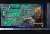
in reading you're basically dry now, maybe a sprinkle along 422. 322 in chester county a sprinkle and the 30 bypass you're fine near coatesville out near lancaster you've got a sprinkle out there. so, we're going see a sprinkle through the early morning hours and that's about it. the rest of the day it's dry but lots of clouds and you see he that here on satellite six and action radar but even those clouds will break for a little sunshine later on. it's cool to start you off. 54 in quakertown, 59 in pottstown, 58 this morning in kennett square and saint davids. 64, though n-center city right now. in some of the suburbs in new jersey, just 61 in browns mills and hammonton, 62 in glassboro near rowan university. 62 degrees in dover, delaware looking at the school forecast as you're getting up getting going out there, early this morning at 7:00 a.m., 63 degrees. we'll have a cloudy start and we'll watch for a sprinkle, maybe send the kids with a little hoodie. by noon 70 degrees. we'll be dry at that point with mostly cloudy skies and then by 4:00 p.m., 74 as they're coming home from the
in reading you're basically dry now, maybe a sprinkle along 422. 322 in chester county a sprinkle and the 30 bypass you're fine near coatesville out near lancaster you've got a sprinkle out there. so, we're going see a sprinkle through the early morning hours and that's about it. the rest of the day it's dry but lots of clouds and you see he that here on satellite six and action radar but even those clouds will break for a little sunshine later on. it's cool to start you off. 54 in quakertown,...
281
281
Sep 22, 2015
09/15
by
WPVI
tv
eye 281
favorite 0
quote 0
karen. >> few sprinkles out there. storm tracker6 live double scan showing mostly north and west of the city in reading lancaster and we could see a sprinkle through the morning hours. it's 64 degrees in the city. here's a look at your day ahead. a high of 76 today. by 9:00 a.m., 66. by noon, 70's. we're dry. by 3:00 p.m., 76, a bit more sunshine in the afternoon. by 6:00 p.m., 73 coming down from a high of 76. >> and a reminder of course if you're trying to keep on top of what's going on with world meeting of families and the pope, school closures, the whole bit 6abc.com is a constant resource and facebook. please keep an eye there. we'll be back in 30 with updates. for matt, matt, nydia, karen and dave, i'm tam. we thought we'd be ready. but demand for our cocktail bitters was huge. i could feel our deadlines racing towards us. we didn't need a loan. we needed short-term funding. fast. our amex helped us fill the orders. just like that. you can't predict it, but you can be ready. another step on the journey. will you
karen. >> few sprinkles out there. storm tracker6 live double scan showing mostly north and west of the city in reading lancaster and we could see a sprinkle through the morning hours. it's 64 degrees in the city. here's a look at your day ahead. a high of 76 today. by 9:00 a.m., 66. by noon, 70's. we're dry. by 3:00 p.m., 76, a bit more sunshine in the afternoon. by 6:00 p.m., 73 coming down from a high of 76. >> and a reminder of course if you're trying to keep on top of what's...
125
125
Sep 27, 2015
09/15
by
WRC
tv
eye 125
favorite 0
quote 0
light sprinkles. the northeast and washington getting a few sprinkles and just outside into prince george's county getting a few sprinkles into largo and marlboro. and farther to the west getting a few and prince william, these again advancing to the north and the metro area. cool morning. you're in the 50s right in washington. low 60s. low 60s right around the bay. it's like a wet pattern setting up here for much of the week ahead. look at our rain chances. that's ahead in a few minutes. >> thank you, tom. this morning more than a dozen people are recovering after a stage collapsed in arizona. police say the crowd may have pushed the stage causing it to collapse. nine people were taken to the hospital. it happened near phoenix yesterday. >>> well, we have new information this morning about a deadly hit-and-run in clarksburg. police arrested this man, ryan salandy. they say he admitted to intentionally running over william mcdaniel. this happened on sweet spire kriesh near daniel's home. they say it b
light sprinkles. the northeast and washington getting a few sprinkles and just outside into prince george's county getting a few sprinkles into largo and marlboro. and farther to the west getting a few and prince william, these again advancing to the north and the metro area. cool morning. you're in the 50s right in washington. low 60s. low 60s right around the bay. it's like a wet pattern setting up here for much of the week ahead. look at our rain chances. that's ahead in a few minutes....
313
313
Sep 13, 2015
09/15
by
WUSA
tv
eye 313
favorite 0
quote 0
a couple light sprinkles around noontime. the sprinkles and showers will mostly be to the south and west of the beltway as we head into the afternoon. just about anywhere you could get a quick pop-up shower. this is not going to last for more than 10, 15 minutes at a time. but the winds are going to be a little bit of an issue today. you see that here on the wind gust tracker. at noon gusting to 20 miles an hour. afternoon hours gusting a little bit higher than that. maybe around 25 miles an hour for that highest wind gust. so it will get gusty as we head into the afternoon. especially in comparison so that stagnant weather we had for so long. here is the first alert seven-day forecast. beautiful tomorrow. 78 degrees and sun. back to you. >>> fans, you have been waiting all summer. we are just hours away now from the kickoff redskins regular season. you can see it right here on wusa 9. starting bgov.com kurt cousins has a tough task. -"usa today" reports it will be colt mccoy the second string quarterback and not robert griff
a couple light sprinkles around noontime. the sprinkles and showers will mostly be to the south and west of the beltway as we head into the afternoon. just about anywhere you could get a quick pop-up shower. this is not going to last for more than 10, 15 minutes at a time. but the winds are going to be a little bit of an issue today. you see that here on the wind gust tracker. at noon gusting to 20 miles an hour. afternoon hours gusting a little bit higher than that. maybe around 25 miles an...
60
60
Sep 23, 2015
09/15
by
WTXF
tv
eye 60
favorite 0
quote 0
. >> sprinkles the overweight cat was taken in. 33 pounds. >> all my sprinkles needs to be smaller. >> we are joined by a guest. he is a progressive. we are happy to have you. you talking with someone who's involved in an issue with the head of the national guard. >> so if you want to join the national guard you have to meet some requirements. you have to meet medical and physical requirements, your waste must be 39 inches or smaller. the commander-in-chief is not held to those standards. governor christie appointed the brigadier in 2012. he wasn't meeting those standards. it has been reported that they wrapper mandated last year. reports say he skipped his annual physical fitness test for several years and took the test in 2013 and flaunt it because his waist was 39 and a half inches around. they are giving him 90 days to meet the requirements. he has started a training program. >> how was he able to skip a physical? >> when you read the reports you hear of a lot of people who got let go for not meeting the requirements. i'm not sure whose responsibility it is to make sure they take
. >> sprinkles the overweight cat was taken in. 33 pounds. >> all my sprinkles needs to be smaller. >> we are joined by a guest. he is a progressive. we are happy to have you. you talking with someone who's involved in an issue with the head of the national guard. >> so if you want to join the national guard you have to meet some requirements. you have to meet medical and physical requirements, your waste must be 39 inches or smaller. the commander-in-chief is not held...
132
132
Sep 22, 2015
09/15
by
WPVI
tv
eye 132
favorite 0
quote 0
any of us could see a sprinkle. it's not going to amount to much today and it will just be through the morning hours. satellite6 and action radar showing lots of clouds for us and as we look at the temperatures, 58 degrees in martins creek, 55 in quakertown, 58 in saint davids, 65 in center city on this last day of summer. it's 61 in ewing, 62 in cinnaminson. just thought i would depress you with that. 62 degrees in dover, delaware. so, hey, time to get ready for school, everybody up and at 'em. hopefully they're awake at my house. cloudy start, sprinkle around especially to the northwest. by noon 70. by 4:00 p.m., 74. our high today 76. feeling a little cool but matt temperatures right about average. a little bit of a change tomorrow. details in that seven-day forecast. >> your efforts to depress worked. did you hear me he groaning over here. nice. >> thanks. >> end of summer can't believe it. googood morning, karen. good morning, everybody. we're just starting our tuesday morning and so far it doesn't look so bad
any of us could see a sprinkle. it's not going to amount to much today and it will just be through the morning hours. satellite6 and action radar showing lots of clouds for us and as we look at the temperatures, 58 degrees in martins creek, 55 in quakertown, 58 in saint davids, 65 in center city on this last day of summer. it's 61 in ewing, 62 in cinnaminson. just thought i would depress you with that. 62 degrees in dover, delaware. so, hey, time to get ready for school, everybody up and at...
169
169
Sep 13, 2015
09/15
by
WRC
tv
eye 169
favorite 0
quote 0
so there's a slight chance of an additional sprinkle. right now the storm team 4 radar showing those right here in central fairfax county and that may move into the district in montgomery county. a few sprinkles here on the county border with prince george's and anne arundel and crofton and bowie. those are quickly dissipating. cooler air is moving in. only near 60. oakland down to a chilly 45 now. reagan national at 64. nearby suburbs are in the low 60s. low to mid 60s around the bay. post your pictures like this gorgeous sunset near front royal. post on facebook as well. share them on instagram. i love to see your photos when you're out and about on the weekend. a great morning for a morning run and the triathlon. and the clouds around now will break up and we'll have some sun breaking out, but small chance of a sprinkle this afternoon. winds may pick up too. we can have gusts of wind around 25 or 20 mile per hour out of the north and west as we climb into the low to mid 70s by this afternoon. football at fedex field this afternoon. pa
so there's a slight chance of an additional sprinkle. right now the storm team 4 radar showing those right here in central fairfax county and that may move into the district in montgomery county. a few sprinkles here on the county border with prince george's and anne arundel and crofton and bowie. those are quickly dissipating. cooler air is moving in. only near 60. oakland down to a chilly 45 now. reagan national at 64. nearby suburbs are in the low 60s. low to mid 60s around the bay. post...
153
153
Sep 22, 2015
09/15
by
WPVI
tv
eye 153
favorite 0
quote 0
for the rest of us we'll see a chance for a sprinkle. it's mostly dry but lots of clouds and kind of cool today. 55 degrees in quakertown, 58 in pottstown, saint davids, 65 in center city. we're looking at 61 in browns mills, 62 in buena and 62 good morning in dover, delaware. as you're heading outside, lots of clouds, a sprinkle in a few spots but especially those light showers out to the north and west. they'll be dissipating within the next couple hours. 76 degrees for your high today, so certainly feeling a bit cool similar to yesterday but we are going to many what up at least a little bit come tomorrow. details on that in the seven-day forecast in just a minute, matt. >> warming up for the start of fall i guess. >> yes, makes perfect sense somewhere. >> exactly as do many things. googood morning, everybody. it was a much quieter night overnight than the night before. things mostly stayed opened without a lot of major accidents. what's not open is the ben franklin parkway and it's not going to be reopened until sometime next week be
for the rest of us we'll see a chance for a sprinkle. it's mostly dry but lots of clouds and kind of cool today. 55 degrees in quakertown, 58 in pottstown, saint davids, 65 in center city. we're looking at 61 in browns mills, 62 in buena and 62 good morning in dover, delaware. as you're heading outside, lots of clouds, a sprinkle in a few spots but especially those light showers out to the north and west. they'll be dissipating within the next couple hours. 76 degrees for your high today, so...
51
51
Sep 30, 2015
09/15
by
KGO
tv
eye 51
favorite 0
quote 0
. >> we could see some sprinkles by this morning. live doppler hd is showing we have green on the scene. it is offshore. it is riding along the moisture that is an upper level jet. as we zoom in closer on live doppler hd you notice that the rain is still well offshore and as it continues to hold together the bulk of the moisture will likely move into the south bay around the 10:00 a.m. hour. it will take you to future weather, temperatures and cloud cover combine and but are waking up to temperatures in the 50s with overcast skies. you can see the spots of green and they will continue into the early afternoon and evening. by 6:00 we still have wet weather in the south bay with a lot of clouds. right now it is quiet but the highs are showing limits sunshine and a threat of showers along the peninsula and the south bay with temperatures in the 70s. how is the traffic, leyla? >> we start off with traffic on the eastern span of the bay bridge moving with no accidents. on the altamont pass you can see the traffic is building coming from t
. >> we could see some sprinkles by this morning. live doppler hd is showing we have green on the scene. it is offshore. it is riding along the moisture that is an upper level jet. as we zoom in closer on live doppler hd you notice that the rain is still well offshore and as it continues to hold together the bulk of the moisture will likely move into the south bay around the 10:00 a.m. hour. it will take you to future weather, temperatures and cloud cover combine and but are waking up to...
212
212
Sep 13, 2015
09/15
by
WRC
tv
eye 212
favorite 0
quote 1
sprinkle. just a small chance of that. otherwise just a few clouds will be floating on through by the afternoon. look at the temperatures, quickly jumping. we were in the low to mid 50s, shenandoah valley at dawn. now in the low 60s though. oakland, 45 right now. the rest of west virginia is in the 50s. metro area, low to mid 60s nearby suburbs and near 70 near chesapeake bay this morning. a beautiful autumn morning. things are still parched. i took this photo of a lawn in montgomery county on friday under that blue sky. the weekend rains helped out a little bit and the apple trees are almost touching the ground. they're so heavily laden with apples. this photo taken at orrs orchard. i love the autumn apples. temperatures climbing into the upper 60s, near 70 during the tailgate time. kickoff at 1:00. ought to be in the low 70s at fedex field. a small chance of a sprinkle during the game. in the low to mid 70s during the rest of the afternoon. we'll have that wind begin to diminish a bit under p
sprinkle. just a small chance of that. otherwise just a few clouds will be floating on through by the afternoon. look at the temperatures, quickly jumping. we were in the low to mid 50s, shenandoah valley at dawn. now in the low 60s though. oakland, 45 right now. the rest of west virginia is in the 50s. metro area, low to mid 60s nearby suburbs and near 70 near chesapeake bay this morning. a beautiful autumn morning. things are still parched. i took this photo of a lawn in montgomery county on...
103
103
Sep 26, 2015
09/15
by
WRC
tv
eye 103
favorite 0
quote 0
a few sprinkles to our south. tonight, maybe a sprinkle late in the evening, otherwise cloudy with temperatures in the 60s. the landmark music festival on the mall there at west potomac park for this saturday. low 70s at the park, a slight chance of a few sprinkles there. on sunday, might get a few sprinkles, a small chance mainly in the morning but the concert under way in the afternoon. should be fine. a cloudy sky, low 70s there. as we get back to work and school on monday, looks cloudy, might get a passing shower. highs, low to mid-70s.ç sun back on tuesday with high around 80. upper 70s and partly sunny on wednesday. then toward thursday might get another chance of a passing shower. otherwise, just a few clouds coming and going. highs low to mid-70s on thursday and, again, on friday. >> all right, tom, thank you. >>> this story is getting a lot of attention. folks trying to do all they can to be blessed by the pope. >> but drinking his water? we'll tell you what one lawmaker says he swiped from pope says he
a few sprinkles to our south. tonight, maybe a sprinkle late in the evening, otherwise cloudy with temperatures in the 60s. the landmark music festival on the mall there at west potomac park for this saturday. low 70s at the park, a slight chance of a few sprinkles there. on sunday, might get a few sprinkles, a small chance mainly in the morning but the concert under way in the afternoon. should be fine. a cloudy sky, low 70s there. as we get back to work and school on monday, looks cloudy,...
124
124
Sep 20, 2015
09/15
by
WCBS
tv
eye 124
favorite 0
quote 0
and a few stray sprinkles. as we roll through the mid- morning hours, skies will clear as dryer air moves in. the break down, 9:00 a.m., 70. mostly cloudy, a few stray sprinkles, especially east of the city. by noon, i think we're all dry, 73 looking good. by 3:00, mostly sunny and 77. it will feel like 77 and it will be breezy, folks. we could have gusts as high as 25 miles per hour this afternoon. that is a look at today's forecast. coming up, we'll talk the workweek and the pope's visit. andrea and diane, back to you. >>> we have breaking news this morning. 6 murders in under 12 hours. police are investigating a violent weekend in new york city. >> the latest incident was a triple deadly shooting in fort green. cbs 2 news' ilona gold is live on that scene with the details. >> reporter: police say three men are dead after a shooting a this housing complex. it happened in the courtyard here at the ingersoll houses. investigators have been on scene all morning trying to get some answers on what led to this. and
and a few stray sprinkles. as we roll through the mid- morning hours, skies will clear as dryer air moves in. the break down, 9:00 a.m., 70. mostly cloudy, a few stray sprinkles, especially east of the city. by noon, i think we're all dry, 73 looking good. by 3:00, mostly sunny and 77. it will feel like 77 and it will be breezy, folks. we could have gusts as high as 25 miles per hour this afternoon. that is a look at today's forecast. coming up, we'll talk the workweek and the pope's visit....
40
40
Sep 21, 2015
09/15
by
WNYW
tv
eye 40
favorite 0
quote 0
these are sprinkles that have been trying to make it in. as they get closer, they hit the dry air and evaporate. light sprinkles, light showers. fox 5 sky guardian shows this trying to move our way. you might run into a sprinkle this evening and during the out there. high pressure is ridging down from new england and that's going to fight all of this off after we get through tomorrow. on the big picture, you can see the high here and we find the cloud cover and a little sprinkle activity going off to our south and west. once that moves along and the high takes over, it's a dry forecast for the rest of the week and beautiful. the good and bad thing i've been saying. we need the rain, but there's nothing coming of significance. a lot of clouds tomorrow. a sprinkle or two in the morning. 60 through 9:00 a.m. 60 at lunchtime. i'm thinking more sun in the middle to later part of the afternoon. at that point, we'll hit 74. there's the futurecast showing the high building down. you can see the clouds just streaking up from the south and west. brig
these are sprinkles that have been trying to make it in. as they get closer, they hit the dry air and evaporate. light sprinkles, light showers. fox 5 sky guardian shows this trying to move our way. you might run into a sprinkle this evening and during the out there. high pressure is ridging down from new england and that's going to fight all of this off after we get through tomorrow. on the big picture, you can see the high here and we find the cloud cover and a little sprinkle activity going...
96
96
Sep 26, 2015
09/15
by
WRC
tv
eye 96
favorite 0
quote 0
just a slight chance maybe of a sprinkle. maybe on sunday morning and again this evening, late evening, highs, low 70s, both of those days. we get back to work and school on monday. a lot of clouds are on monday, too, still a possibility of a passing shower. highs in the mid-70s. a much smaller chance on tuesday with highs around ç80. sunshine returns. partly sunny each day, wednesday, thursday, friday, highs in the 70s. maybe a passing shower on thursday. that's the way it looks. >> here are the four things you need to know at 6:53. montgomery county, police investigating the deadly hit and run in clarksburg. witnesses say they saw the picture and driver arguing moments before this happened. >>> pope francis is expected to arrive in philadelphia around 9:30 this morning. for the last two days of his u.s. trip. he'll celebrate mass at 10:30 and visit independence hall and the festival of families. >>> families in mcclain, virginia are going to protest a new gun shop opening near an elementary school. a demonstration expecte
just a slight chance maybe of a sprinkle. maybe on sunday morning and again this evening, late evening, highs, low 70s, both of those days. we get back to work and school on monday. a lot of clouds are on monday, too, still a possibility of a passing shower. highs in the mid-70s. a much smaller chance on tuesday with highs around ç80. sunshine returns. partly sunny each day, wednesday, thursday, friday, highs in the 70s. maybe a passing shower on thursday. that's the way it looks. >>...
178
178
Sep 21, 2015
09/15
by
WABC
tv
eye 178
favorite 0
quote 0
a couple of sprinkles maybe. tomorrow maybe some sprinkles and we'll clear out. it will be chilly the first morning of fall, the 40s north and west. is the next chance of rain not until sunday? if that doesn't happen will the drought last into october? more on that in our 7 day forecast in the next half hour. >> thank you, lee. >>> right now we have more breaking news. this time in newark where a truck fire is causing quite a bit of back up. shannon stone is in news copper 7 with more. >> reporter: they got the fire out but this cab of this tractor trailer completely gone. this is all happening on the southbound side of 109 and the expressway lanes just south of you can see that the express lanes northbound are shut down as welch this is a nightmare. the northbound side is being forced over to the local lanes and the southbound side has become a huge problem. everyone is being forced into the local lane there is as well. these delays spill onto 21 as well as 78. unfortunately they have not expressed a time to get this cleared out of here. reporting live, shannon
a couple of sprinkles maybe. tomorrow maybe some sprinkles and we'll clear out. it will be chilly the first morning of fall, the 40s north and west. is the next chance of rain not until sunday? if that doesn't happen will the drought last into october? more on that in our 7 day forecast in the next half hour. >> thank you, lee. >>> right now we have more breaking news. this time in newark where a truck fire is causing quite a bit of back up. shannon stone is in news copper 7 with...
61
61
Sep 21, 2015
09/15
by
WNYW
tv
eye 61
favorite 0
quote 0
there are some of the showers or sprinkles. we'll see how much of those survive as they slide eastward. we'll look at the big picture. the battle zone is going to be to our south. most of the rain is going to be in this locale as the high pressure ridges on down the next couple of days. we'll be in good shape. tomorrow. a lot of clouds. a couple of breaks of sun, more so in the afternoon. the sprinkle threat in the morning. 60 out the door. 68 at lunchtime. we'll stop at 74 tomorrow. again, that is seasonal for this time of year. let's watch the futurecast. here comes the high building down. notice we find a bit of cloud cover the story as we head into tomorrow. then the clouds go away. let high build -- the high beautiful andy sunny wednesday and thursday. eventually we will see a little bit of a change in temperatures later in the week when the front slips back southward. overall, i think you'll like what's coming our way. once again, we need the rain and there's not much coming. a couple of sprinkles overnight. 50s out in th
there are some of the showers or sprinkles. we'll see how much of those survive as they slide eastward. we'll look at the big picture. the battle zone is going to be to our south. most of the rain is going to be in this locale as the high pressure ridges on down the next couple of days. we'll be in good shape. tomorrow. a lot of clouds. a couple of breaks of sun, more so in the afternoon. the sprinkle threat in the morning. 60 out the door. 68 at lunchtime. we'll stop at 74 tomorrow. again,...
167
167
Sep 30, 2015
09/15
by
KPIX
tv
eye 167
favorite 0
quote 0
a sprinkle a little -- a smudge of rain a sprinkle, a little drop. we'll keep our fingers crossed that we'll see something. out the door right now mostly cloudy 49 degrees right now in santa rosa. pretty chilly up there. san jose 59. mild pretty much everyone where else. here's hi-def doppler right now we are seeing some light showers south of us basically monterey bay south. there's a chance some of that will sneak north and some folks south of the golden gate may get a couple of sprinkles today not a significant rain event but at least we have something to talk about. today plenty of clouds, shower chances for the next 36 hours and warming up on the weekend. we'll pinpoint that in a bit. >>> roads are looking good. caltrans have shut down the east 80 connector ramp to southbound 680 for construction from overnight. it is expected to be closed until 6:00 so avoid the area. avoid the area and expect detours. westbound 580 is crowded from the 205 interchange approaching vasco this morning. the bay bridge toll plaza is looking good. so far no delays at
a sprinkle a little -- a smudge of rain a sprinkle, a little drop. we'll keep our fingers crossed that we'll see something. out the door right now mostly cloudy 49 degrees right now in santa rosa. pretty chilly up there. san jose 59. mild pretty much everyone where else. here's hi-def doppler right now we are seeing some light showers south of us basically monterey bay south. there's a chance some of that will sneak north and some folks south of the golden gate may get a couple of sprinkles...
114
114
Sep 21, 2015
09/15
by
WPVI
tv
eye 114
favorite 0
quote 0
there's a chance of a spotty sprinkle or shower. the last run i looked at before we went on the air this new run doesn't really have anything, but you have to allow are to -- for it. the northeast flow will keep us cooler than it was over the weekend. we're going for a high of 76 degrees. if there's a shower it's mostly down the shore. can't rule out something coming into philadelphia. looks like the low will be far enough away where the impact precipitation wise is relatively light. here's the fall forecast. 74 degrees is the high. cooler than the weekend and clouds increasing. tomorrow mostly cloudy skies, 76. we have to allow for a spotty sprinkle or shower down the shore, yom kippur arriving at sundown. fall arrives on wednesday, sunny and high of 80 degrees, a nice day there. thursday, still nice, partly sunny, 79 degrees and 77 on friday. looks like a frontal boundary will be popping through on saturday night. saturday, cooler, 70. clouds and sun. if there's a sprinkle and shower saturday it's likely south of philadelphia. so
there's a chance of a spotty sprinkle or shower. the last run i looked at before we went on the air this new run doesn't really have anything, but you have to allow are to -- for it. the northeast flow will keep us cooler than it was over the weekend. we're going for a high of 76 degrees. if there's a shower it's mostly down the shore. can't rule out something coming into philadelphia. looks like the low will be far enough away where the impact precipitation wise is relatively light. here's the...
130
130
Sep 30, 2015
09/15
by
KGO
tv
eye 130
favorite 0
quote 0
the policy of sprinkles. we will check with drew. >> exciting news. we have activity on live doppler hd zooming into the south bay with green and some of us may not be reaching the ground. a better chance later this morning as we have at 10:00, the atmosphere will be more invigorate the at the south bay with the temperatures in the low 60s. have the umbrella handy. leyla? >>> good morning, everyone, we have a busy bay bridge toll plaza with the largest parking lots in the bay area is 18 minutes between the macarthur maze and san francisco so pick the patience. you can see the brake lights into treasure island to the western span of the bay bridge. we have a couple of citizens. -- accidents. southbound 242 at 680 the delays are building through concord and it eases up into pleasant hill. >> the internet and social media are buzzing over tesla's latest offering taking the wraps off the latest model and s.u.v. last night. our reporter is in fremont with the details. >> imagine the impression you make if you pull up to the play date in this: check out the
the policy of sprinkles. we will check with drew. >> exciting news. we have activity on live doppler hd zooming into the south bay with green and some of us may not be reaching the ground. a better chance later this morning as we have at 10:00, the atmosphere will be more invigorate the at the south bay with the temperatures in the low 60s. have the umbrella handy. leyla? >>> good morning, everyone, we have a busy bay bridge toll plaza with the largest parking lots in the bay...
96
96
Sep 30, 2015
09/15
by
WRC
tv
eye 96
favorite 0
quote 0
as we get the afternoon going on, just a few sprinkles now. a small chance of a passing sprinkle in the afternoon. here's the future weather hour by hour. this area in the green, maybe around 2:00 or 3:00, a few sprinkles south and east of the metro area. southern maryland, lower neck, part of the eastern shore by 4:00 p.m. pretty much all gone, just clouds around. a little sunshine coming and going. that's the way it looks. >> thanks, tom. >>> more talk about the future of rfk stadium today. there's a meeting at the washington convention center, a follow-up from another one a few weeks ago. according to "the washington post," neighbors who live near rfk say they did not want the redskins to build a new stadium there. >>> today is your last chance to visit the crime and punishment museum. the museum is in northwest. it's closing today after seven years. the people in charge say they were asked to leave their building, and they didn't have a choice. the museum will continue to offer some programs like walking tours and traveling educational pro
as we get the afternoon going on, just a few sprinkles now. a small chance of a passing sprinkle in the afternoon. here's the future weather hour by hour. this area in the green, maybe around 2:00 or 3:00, a few sprinkles south and east of the metro area. southern maryland, lower neck, part of the eastern shore by 4:00 p.m. pretty much all gone, just clouds around. a little sunshine coming and going. that's the way it looks. >> thanks, tom. >>> more talk about the future of rfk...
145
145
Sep 29, 2015
09/15
by
WABC
tv
eye 145
favorite 0
quote 0
a couple of sprinkles above 287, 84. a couple of sprinkles to huntington. that is the soupy air that we have. the real deal is to the west. that comes in this evening and tonight. the front comes in wednesday. we are looking at heavy rain. tropical storm joaquin is what we are watching for the weekend. it will put surf and waves in to the coast but it will meander for a day or two. it hangs around until friday then high pressure will steer that northerly up the coast. it will be in between systems so once the front goes by that will allow this to come up the coast. you look at the cone. that takes up the western side of that for the west coast. we will see what happens. it could change. spotty shower today. warm and soupy. 81. tonight 68 with rain that could cause flooding. then tomorrow it's rainy, humid, flooding possible, 74. your accuweather seven-day forecast, we have cool showers on thursday and it's 61 friday with a couple of showers and maybe even a shower on saturday or sunday. >> we needed eight inches of rain. we could have it by sunday, monday.
a couple of sprinkles above 287, 84. a couple of sprinkles to huntington. that is the soupy air that we have. the real deal is to the west. that comes in this evening and tonight. the front comes in wednesday. we are looking at heavy rain. tropical storm joaquin is what we are watching for the weekend. it will put surf and waves in to the coast but it will meander for a day or two. it hangs around until friday then high pressure will steer that northerly up the coast. it will be in between...
51
51
Sep 13, 2015
09/15
by
WRC
tv
eye 51
favorite 0
quote 0
a small chance of a sprinkle. low to mid 70s during the game. then by dawn tomorrow, feeling autumnal. this is the type of -- time of year i guess to use the word autumnal. say it three times really fast. >> autumnal, autumnal, autumnal. >> the coolest morning since last spring. then upper 70s tomorrow afternoon. a gorgeous week as far as the weather goes, but we need the rain. we'll have it comfortable in the 80s and low humidity into next weekend. >>> well, tennis star james blake is calling on the nypd to make changes after he was tackled by the police officer. kristin dahlgren reports. >> reporter: for james blake, watching the video is still difficult. >> i didn't even realize it until i hit the ground it wasn't a friendly encounter. i hit the ground and the first words out of my mouth were 100% cooperating, he said turn over, put your hands behind your back. >> reporter: blake was outside the hotel wednesday when he was taken down hard. >> i don't know what a normal linebacker tackle would be but i would say some nfl guys were pretty proud
a small chance of a sprinkle. low to mid 70s during the game. then by dawn tomorrow, feeling autumnal. this is the type of -- time of year i guess to use the word autumnal. say it three times really fast. >> autumnal, autumnal, autumnal. >> the coolest morning since last spring. then upper 70s tomorrow afternoon. a gorgeous week as far as the weather goes, but we need the rain. we'll have it comfortable in the 80s and low humidity into next weekend. >>> well, tennis star...
102
102
Sep 30, 2015
09/15
by
KGO
tv
eye 102
favorite 0
quote 0
sprinkles. >> a welcome change. live doppler hd is showing green on the screen. it is a confined area of rain. it is running along the high clouds. and a cold front will press to the south bay. around san jose. willowwillow glen. light showers. drizzle. temperatures in the 50s through the morning. by 10:00, light showers primarily in the south bay. san jose near the tank and julian street headed into downtown san jose not going to be an issue with light conditions in and out of downtown. we have an accident in the east bay along the nimitz freeway traveling southbound with a vehicle a solo crash blocking one lane with no delays. in marin, we have a new accident involving a make and possible major injuries at 101 and tiburon boulevard. >> new details in the death of ain't mate at the santa clara county jail. we have learned the man's identity. there was an incident involving guards before his death. janet o is in san jose with the story. janet? >> we have learned the inmate found dead this his ce
sprinkles. >> a welcome change. live doppler hd is showing green on the screen. it is a confined area of rain. it is running along the high clouds. and a cold front will press to the south bay. around san jose. willowwillow glen. light showers. drizzle. temperatures in the 50s through the morning. by 10:00, light showers primarily in the south bay. san jose near the tank and julian street headed into downtown san jose not going to be an issue with light conditions in and out of downtown....
99
99
Sep 21, 2015
09/15
by
WABC
tv
eye 99
favorite 0
quote 0
a couple sprinkles over the poconos and a few more sprinkles later. this stationery area of low pressure sitting off the outer banks. there's plenty of rain and beach erosion there. but that disturbance isn't to shift offshore. we're watching a cold front. a couple thousand miles away. but it's going to come eastward. it will shove all that cloudiness offshore. and out ahead of the cold front there's a nice warm up. behind it is more fall temperatures. but you see what we have right now, one of the coolest days in a while since late june. ahead of that front, it's getting into the 80s in places like winnipeg canada. 89 in bismarck. we have another warm up that will come up just as we start autumn. then another cool shot as we approach the upcoming weekend. so tomorrow, cooler, with a fair amount of cloudiness around. this afternoon, high clouds around. especially south of the city. tomorrow, mostly cloudy. best chance of being brighter, will be northwest. we'll stop in the low and mid 70s. kind of cool. a northeast breeze and minimal sunshine. a coupl
a couple sprinkles over the poconos and a few more sprinkles later. this stationery area of low pressure sitting off the outer banks. there's plenty of rain and beach erosion there. but that disturbance isn't to shift offshore. we're watching a cold front. a couple thousand miles away. but it's going to come eastward. it will shove all that cloudiness offshore. and out ahead of the cold front there's a nice warm up. behind it is more fall temperatures. but you see what we have right now, one of...
99
99
Sep 12, 2015
09/15
by
KGO
tv
eye 99
favorite 0
quote 0
a few sprinkles. we had them coming in this morning. better as we go through the afternoon on monday. so it's all due to the system i showed you that's offshore. high pressure that just didn't want to go anywhere for about seven days finally is getting nudged to the east and return flow around it bringing up the subtropical moisture and that's allowing for the cloud cover, perhaps the sprinkles and the activity in the sierra nevada for the days ahead and much of southern and central california. this is sunday, 2:00. looks a lot like today with the partly sun hi conditions, high clouds streaming up from the south and monday afternoon you will notice from the moisture in the clouds is being picked up from this forecast model. whether or not it reaches the ground is another question. in the sierra nevada you could see a quarter inch or more than that throughout early next week. in terms of the highs across the state, still hot and hazy with the fires from the southern sierra. yosemite 99. 87 in lake tahoe. hazy there, and the week ahead in
a few sprinkles. we had them coming in this morning. better as we go through the afternoon on monday. so it's all due to the system i showed you that's offshore. high pressure that just didn't want to go anywhere for about seven days finally is getting nudged to the east and return flow around it bringing up the subtropical moisture and that's allowing for the cloud cover, perhaps the sprinkles and the activity in the sierra nevada for the days ahead and much of southern and central california....
102
102
Sep 27, 2015
09/15
by
WRC
tv
eye 102
favorite 0
quote 0
these little patches of green, just a few sprinkles. then down 95 west of there, southern prince william county, these are tracking off to the north. so a few of these scattered sprinkle as under hear for maybe another hour or two. temperatures are still rather cool. only the low 60s in the metro area and around the bay. mid to upper 60s. and out of the mountains it's in the low to mid-50s. if you plan a morning run, we'll have temperatures in the 60s through 11:00 and the clouds should break up during the afternoon. mild as the temperatures reach the low 70s. look at a wet pattern that's going to be commencing and much of the week ahead, that's going to come up in a few minutes. >> thank you, tom. some lanes are now open on northbound connecticut avenue near pliers mill road. police say a driver slammed into a pole around 11:00 last night in the kensington neighborhood. police tweeting out this photo. there's still no word on the was of the crash. we do know that one person was taken to the hospital and that individual has serious inju
these little patches of green, just a few sprinkles. then down 95 west of there, southern prince william county, these are tracking off to the north. so a few of these scattered sprinkle as under hear for maybe another hour or two. temperatures are still rather cool. only the low 60s in the metro area and around the bay. mid to upper 60s. and out of the mountains it's in the low to mid-50s. if you plan a morning run, we'll have temperatures in the 60s through 11:00 and the clouds should break...
95
95
Sep 27, 2015
09/15
by
WPVI
tv
eye 95
favorite 0
quote 0
higher humidity and sprinkle or shower as you just saw. tuesday some of the models are suggesting more significant rain coming in the afternoon or evening. another high of 80. we could use the rain, obviously we're hoping it works out that way. wednesday, lingering showers, otherwise, clouds and sun, hopefully dry in the evening for the union's u.s. cup match at ppl park and it looks like we're back in the 60s by thursday and friday and maybe saturday, as well. >> "action news" the morning team will be here very early tomorrow morning to help you navigate through some of the continuing street and bridge closures, so we'll look for you to join us for weather news and bracing news at 4:00 a.m. a lot of people think it is monday because they see us here. it is still sunday, you didn't oversleep to go to work. our coverage of pope francis continues. let's take a live look at the ben franklin bridge, the pedestrian bridge, the sun is expected to come up a6:53 a.m. it is sunday and pope francis is saying mass this afternoon. my guys are with me,
higher humidity and sprinkle or shower as you just saw. tuesday some of the models are suggesting more significant rain coming in the afternoon or evening. another high of 80. we could use the rain, obviously we're hoping it works out that way. wednesday, lingering showers, otherwise, clouds and sun, hopefully dry in the evening for the union's u.s. cup match at ppl park and it looks like we're back in the 60s by thursday and friday and maybe saturday, as well. >> "action news"...
84
84
Sep 30, 2015
09/15
by
KTVU
tv
eye 84
favorite 0
quote 0
but a few sprinkles toward novato as well. numbers updated, showing you 50s, santa rosa the cool spot at 50. mountain view 60 and san jose 59 degrees. the plan for today, mostly cloudy skies. live camera looking out toward san francisco much temperatures no major heat, only in the 60s to low to mid-70s for your wednesday afternoon. you may have noticed minor flooding near the bay yesterday, that could be the case again because we have some inflated tides this afternoon at the golden gate at 1:44. here's what's happening with satellite. the continuous stream of moisture produces excessive rainfall. of still clouds and possibility of scattered showers today through thursday morning as moisture moves in. 60s and 70s and here's our forecast model showing you the shower chance this morning through the morning hours. you'll notice the best chance will be in the south bay. but even to the north we could have a few sprinkles out there, basically 5 p.m. this afternoon and we're going to hold on to that into thursday morning. then skies
but a few sprinkles toward novato as well. numbers updated, showing you 50s, santa rosa the cool spot at 50. mountain view 60 and san jose 59 degrees. the plan for today, mostly cloudy skies. live camera looking out toward san francisco much temperatures no major heat, only in the 60s to low to mid-70s for your wednesday afternoon. you may have noticed minor flooding near the bay yesterday, that could be the case again because we have some inflated tides this afternoon at the golden gate at...
123
123
Sep 12, 2015
09/15
by
KGO
tv
eye 123
favorite 0
quote 0
maybe squeezing out a few sprinkles, light shower. we'll talk more in detail about that and much cooler outlook for next week. >> thank you. we are now getting our first look at a man called a person of interest in the flurry of freeway shootings in arizona. police say he could be the first of several people involved in the incidents that had the city on edge. >> overnight police identifying a man arrested at this arizona gas station as a person of interest in a string of highway shootings rattling the phoenix area. >> our criminal investigation as well as s.w.a.t. >> officers swarming this white suv and taking 19-year-old oscar munoz into custody. >> all we could see was cops coming in and then after that, they disappeared. >> this morning, investigators tell abc news munoz has been charged with marijuana possession but confirm he is still a person of interest in the shooting. questioning him for hours friday night. >> whether or not it's one or two, i can't confirm that. >> may be looking for more than one shooter. august 29th, a gu
maybe squeezing out a few sprinkles, light shower. we'll talk more in detail about that and much cooler outlook for next week. >> thank you. we are now getting our first look at a man called a person of interest in the flurry of freeway shootings in arizona. police say he could be the first of several people involved in the incidents that had the city on edge. >> overnight police identifying a man arrested at this arizona gas station as a person of interest in a string of highway...
126
126
Sep 13, 2015
09/15
by
KPIX
tv
eye 126
favorite 0
quote 0
we did see sprinkles overnight. you can see the sprinkles moving out of the bay area right now. here is what you can expect waking up, a cloudy start with possible sprinkles still around, partly cloudy afternoon and warmer than temperatures we had yesterday around the bay. then a chance of showers returning. we will have a little bit more on that in your seven day. first here are your high temperatures. santa clara you will get to 83, 81 in mountain view, san jose, 83. to the far east bay, our high is 90 in brentwood, 85 in walnut creek. to the central bay, 69 in alameda, same for san francisco, 80 in mill valley. a cooling trend will return monday before the temperatures finally bottom out in the middle of the week wednesday where we are watching for a 30% chance of rain. then the sun returns to end off our work week. >>> a bay area ceo who found himself in legal trouble got former mayor willy brown involved in the case. that has turned ,,,,,,,,,,,,,,,, >>> a san francisco ceo reportedly was willing to go to great lengths to resolve legal trouble after accusations he beat up hi
we did see sprinkles overnight. you can see the sprinkles moving out of the bay area right now. here is what you can expect waking up, a cloudy start with possible sprinkles still around, partly cloudy afternoon and warmer than temperatures we had yesterday around the bay. then a chance of showers returning. we will have a little bit more on that in your seven day. first here are your high temperatures. santa clara you will get to 83, 81 in mountain view, san jose, 83. to the far east bay, our...
80
80
Sep 27, 2015
09/15
by
KYW
tv
eye 80
favorite 0
quote 0
probably likely just some sprinkles. is there the le pressure system and you can see that it is, close by. lets look at, future weather at 5:00 p.m. this is when that papal mass will be going on. we have cloud cover. you do see moisture working its way in. we will keep them in there. you could see them this afternoon. 8:00 a.m. monday. cloudy. we have more moisture working our way toward us as we go throughout the week. so monday, showers around, 70's and we will see that wind, justin. low pressure system starts to track to the north. by tuesday, temperatures warming up to 80-degree high but we have possible showers still out there on tuesday. umbrella damon and tuesday. take it with you. 60 degrees in philadelphia a. about 54 out in lancaster. sixty-one down in dover. if we look at atlantic city about 61 degrees for you. the let's zoom in, cooler in doylestown. good morning to you. fifty-one for you. fifty-five in mount holly. the wind will be a bit of the story to day. it is kicking up to 14 miles an hour in dover. we
probably likely just some sprinkles. is there the le pressure system and you can see that it is, close by. lets look at, future weather at 5:00 p.m. this is when that papal mass will be going on. we have cloud cover. you do see moisture working its way in. we will keep them in there. you could see them this afternoon. 8:00 a.m. monday. cloudy. we have more moisture working our way toward us as we go throughout the week. so monday, showers around, 70's and we will see that wind, justin. low...
79
79
Sep 22, 2015
09/15
by
WNBC
tv
eye 79
favorite 0
quote 0
there could be sprinkles out there. you can see a brief shower as well as warren county in new jersey early on. that should whisk on by to the northeast. the pope leaving dc and arriving at j.f.k. should be 77 degrees. shouldn't be any weather issues. the next day on friday to the united nations we go, 65. at 11:30 at the 9 oe 11 memorial, mid 70s. 74 in east harlem and 73 at central park. no rain anticipated. ideal conditions it should be for most. future tracker does show a few showers early north and west dissipating. clouds hang tough. then you see some clear spots. that's the temperatures today. here's your seven day forecast, looking pretty good. 74. clouds, yes, but then more sunshine tomorrow. it will be a nice, summery day at 81. 80 thursday. 74 and cooler with clouds. weekend, clouder and cooler. rain and shower activity especially sunday. upper 70s on monday. >> lauren? >> things are rolling along pretty nicely. a couple of bus detours. q 44 and q 58. if you're getting on the roads, live look outside at the b
there could be sprinkles out there. you can see a brief shower as well as warren county in new jersey early on. that should whisk on by to the northeast. the pope leaving dc and arriving at j.f.k. should be 77 degrees. shouldn't be any weather issues. the next day on friday to the united nations we go, 65. at 11:30 at the 9 oe 11 memorial, mid 70s. 74 in east harlem and 73 at central park. no rain anticipated. ideal conditions it should be for most. future tracker does show a few showers early...
160
160
Sep 13, 2015
09/15
by
KGO
tv
eye 160
favorite 0
quote 0
a few sprinkles. this is your sunday afternoon with more high and mid-level clouds a few sunny breaks. we will be looking at the possibility of rain in the sierra nevada, as well. really the entire state under a new regime the next couple days. cooler, more fall-like weather after today. 77 in palo alto today. >> 69 richmond, 60s in san francisco. we will call it partly to mostly cloudy today. maybe a few 80s with the sunny breaks. breezy tomorrow with the weather system but at least the temperatures come down. a dryer atmosphere and then we are warming it back up to more unusual conditions for mid-september thursday and friday. >> and i like the possibility of sprinkles. >> yeah, that would be great. >> thank you, lisa. let's check out sports. let's check out sports. let's check out sports. the raiders host the senate bengals today at o.com. it's their home opener. and madison bumgarner pitching a jewel last night at at&t park. here's shu with the morning sports. >> good morning! well, madison bumgar
a few sprinkles. this is your sunday afternoon with more high and mid-level clouds a few sunny breaks. we will be looking at the possibility of rain in the sierra nevada, as well. really the entire state under a new regime the next couple days. cooler, more fall-like weather after today. 77 in palo alto today. >> 69 richmond, 60s in san francisco. we will call it partly to mostly cloudy today. maybe a few 80s with the sunny breaks. breezy tomorrow with the weather system but at least the...
91
91
Sep 22, 2015
09/15
by
WNYW
tv
eye 91
favorite 0
quote 0
whether it makes it to the ground, light rain or sprinkles in that region but cool temperatures for a little while, something interesting with that area of low pressure and developing in southeast atlantic waters, watching closely over the next few days, as we head into the weekend looks like for the most part it is drawing still in the tristate and on the cooler side today, as indeed i midday and high of 74 with partly to mostly cloudy skies, the height of the tomorrow, 78 thursday and 75 on friday, not a lot of rain in a five day some rain going backwards, we are falling behind, let's go to ines and see what is going done, it said thursday morning commute. >> in the cross bronx, looks good on the parkway, other red spots, in interchange 11, just watch out for a lane closures. the lie west bound and eastbound looks good, metro-north long island railroad, the pass trains running on or close to schedule. >> >> pope francis wrapping up his trip to cuba and getting ready to head to washington. >> the president this afternoon at andrews, a joint base, preparations well under way through c
whether it makes it to the ground, light rain or sprinkles in that region but cool temperatures for a little while, something interesting with that area of low pressure and developing in southeast atlantic waters, watching closely over the next few days, as we head into the weekend looks like for the most part it is drawing still in the tristate and on the cooler side today, as indeed i midday and high of 74 with partly to mostly cloudy skies, the height of the tomorrow, 78 thursday and 75 on...
132
132
Sep 22, 2015
09/15
by
WABC
tv
eye 132
favorite 0
quote 0
there are sprinkles to the western suburbs. a day of clouds and then brightening skies and this will be a normal day where summer is ending. here is the current temperature, 63 degrees. humidity dry at 45%. lot how high the pressure is at 30.24. yesterday's high was 73. did we forecast a high of 73 yesterday? i believe so. feeling like summer. it will feel like a fall-like feel for summer's end today. kind of an ironic play in the weather. a close call this weekend with a storm system to the south. it stays to our south in the carolinas. we get clouds off of that for the weekend. we should have dry weather right on through. we will talk about that. murray hill 63. whitestone 62 to 63 down to cambria heights. 63 belmar and 50s to the north and west. northeast wind 7, 8, 10 miles this morning. keeps it cool. with a northerly wind in here, it's kind of dry. that is -- most of these showers are drying out around sussex and warren county, ulster, sullivan and orange county. back to the west more of this high-pressure ridge which has
there are sprinkles to the western suburbs. a day of clouds and then brightening skies and this will be a normal day where summer is ending. here is the current temperature, 63 degrees. humidity dry at 45%. lot how high the pressure is at 30.24. yesterday's high was 73. did we forecast a high of 73 yesterday? i believe so. feeling like summer. it will feel like a fall-like feel for summer's end today. kind of an ironic play in the weather. a close call this weekend with a storm system to the...
92
92
Sep 28, 2015
09/15
by
WPVI
tv
eye 92
favorite 0
quote 0
every now and then, though by 2:30 you see a pop-up sprinkle or shower. if you do see something it's nothing more than light nuisance stuff nothing to alter your plans. it will be warm in the lehigh valley, it will feel humid. down the shore, humid, high of 77 degrees. there are rip currents in the water not only today and the next several days, off-season swimming not a good idea with no lifeguards around. feeling muggy in philadelphia especially in the afternoon and # 3 is the high. feeling like summer after school. 63 degrees by 8:00 a.m. if you have outdoor exercises getting done, get it in by 8:00 a.m. you're in good shape. 11:00 a.m., 74 degrees, we spend the highs in the 80s, 83 around 3:00 p.m. we get into tomorrow, tuesday morning might have sprinkles and light showers to show you on storm tracker 6 live tomorrow morning. you can see how we get into the afternoon and there could heavier cells and more of that by 6:00 a.m. and then you roll overnight and into wednesday morning that's when we are going to start to get inundated with steadier rain.
every now and then, though by 2:30 you see a pop-up sprinkle or shower. if you do see something it's nothing more than light nuisance stuff nothing to alter your plans. it will be warm in the lehigh valley, it will feel humid. down the shore, humid, high of 77 degrees. there are rip currents in the water not only today and the next several days, off-season swimming not a good idea with no lifeguards around. feeling muggy in philadelphia especially in the afternoon and # 3 is the high. feeling...
100
100
Sep 22, 2015
09/15
by
WCBS
tv
eye 100
favorite 0
quote 0
let's check my headlines a few sprinkles out there tonight, not much of anything. same deal for the day tomorrow. i will not rule out wet weather, but anything you pick up, a light little sprinkle or shower. not going to make a dent in the deficit. the first day of fall, looming wednesday morning, 4:21 a.m., that's when you start the fall season. well above normal. the temperature at 80 degrees. currently, okay, cloud cover is pushing through, and then, you know a little bit of a light sprinkle for some folks, the rain is not making its way down. it will never be a lot to begin with. look how basically the weak cold front is moving through the area. northern virginia up into eastern pennsylvania, and a little rain, and that's it the front will slide through, and that's the air mass you're going to deal with for a couple of days, wednesday and thursday, and sunshine overhead, and warmer temperatures. let me show you the numbers we are talking about. tomorrow, 74 degrees, similar to temperaturewise today, but more clouds, and then a sprinkle chance is out there. on w
let's check my headlines a few sprinkles out there tonight, not much of anything. same deal for the day tomorrow. i will not rule out wet weather, but anything you pick up, a light little sprinkle or shower. not going to make a dent in the deficit. the first day of fall, looming wednesday morning, 4:21 a.m., that's when you start the fall season. well above normal. the temperature at 80 degrees. currently, okay, cloud cover is pushing through, and then, you know a little bit of a light sprinkle...
83
83
Sep 28, 2015
09/15
by
WPVI
tv
eye 83
favorite 0
quote 0
tomorrow there might be light sprinkles and showers. 3:00 p.m., more of it fills in. by the dinner hour the latest model runs have this north and west of philadelphia. there's a cold front out to the west that's going to drive the rain through. as we get into wednesday morning, the wave of low pressure and the related front makes us front. it's going to be a wet morning and possibly a wet afternoon and damp in the evening. the exclusive accuweather seven-day forecast, 83, warm and muggy, mainly dry. tomorrow, 83, cloudy and spotty showers around as you just saw. tuesday night into wednesday cloudy skies with rain. we could get one to two inches of rain based on the latest model projections. thursday behind the departing front we are cooler, 63 degrees on thursday and friday. frontal boundary kind of stalling around us keeping us cloudy with showers here or there and we already said friday, saturday, cloudy, 66. there could be an additional shower, looks like we're dry in time for fan appreciation day for phillies sunday afternoon which will be my final appearance at c
tomorrow there might be light sprinkles and showers. 3:00 p.m., more of it fills in. by the dinner hour the latest model runs have this north and west of philadelphia. there's a cold front out to the west that's going to drive the rain through. as we get into wednesday morning, the wave of low pressure and the related front makes us front. it's going to be a wet morning and possibly a wet afternoon and damp in the evening. the exclusive accuweather seven-day forecast, 83, warm and muggy, mainly...
75
75
Sep 30, 2015
09/15
by
KTVU
tv
eye 75
favorite 0
quote 0
rest of the bay area we could have a few sprinkles,
rest of the bay area we could have a few sprinkles,
138
138
Sep 16, 2015
09/15
by
KGO
tv
eye 138
favorite 0
quote 1
yesterday, the high clouds and sprinkles moving away and here is the next batch, light and wet weather for all of us today. at 6:00, can you see bulk of the moisture is around and ukiah headed to noon it will head into the north bay and maybe heavier at times with yellows and oranges around ukiah and as we head to the can hour, you can see north of the san mateo bridge is where we are going to have our best chance of the rain turning into scattered and light showers. 6:00 to 11 o'clock we will start to focus it more on inland east bay and the south bay but, notice, it weakens and the precipitation shield starts to fall apart and the best chance is to the south mainly in the santa cruz mountains and overnight, dry air rolls in maybe a patch of drizzle and increasing sunshine tomorrow. still looking at the north bay for the best part .1" in the valleys and notice some of mountain tops we are getting into .5" to maybe .75" rest us, with a lost light blue which is a trace to .1" on the east bay hills and, also, along the santa cruz mountains we can get up to quarter of an inch. temperature
yesterday, the high clouds and sprinkles moving away and here is the next batch, light and wet weather for all of us today. at 6:00, can you see bulk of the moisture is around and ukiah headed to noon it will head into the north bay and maybe heavier at times with yellows and oranges around ukiah and as we head to the can hour, you can see north of the san mateo bridge is where we are going to have our best chance of the rain turning into scattered and light showers. 6:00 to 11 o'clock we will...
128
128
Sep 21, 2015
09/15
by
WRC
tv
eye 128
favorite 0
quote 0
they're enclosing on the metro and as a result a couple of sprinkles. so as a result as we break your day down hour by hour, temperatures on your way out the door are in the upper 50s to low and mid-60s. as we look at your planner, light rain by mid to late morning. there's a sprinkle or two out early. it's umbrella-ready for your monday. >> sounds good. my flowers are kind of -- not so sure. >> mine have given up the ghost. >> take a look. first of all in camden, because of that person who was hit overnight from derrick ward we're keeping an eye on this. rye now we have nod hat any delays on the camden line. we'll keep you updated here. 95 south at old keen mill road door have an accident there. just a warning you might see southbound lanes. inner loop and outer loop, no problems. we'll see you with travel times in ten minutes. >> thank you, melissa. developing this morning brand-new regulations about cuba. they say the new rules improve the company's abilities to do business there. they can all higher cuban workers. it's still in effect. they'll vote
they're enclosing on the metro and as a result a couple of sprinkles. so as a result as we break your day down hour by hour, temperatures on your way out the door are in the upper 50s to low and mid-60s. as we look at your planner, light rain by mid to late morning. there's a sprinkle or two out early. it's umbrella-ready for your monday. >> sounds good. my flowers are kind of -- not so sure. >> mine have given up the ghost. >> take a look. first of all in camden, because of...
81
81
Sep 22, 2015
09/15
by
WNYW
tv
eye 81
favorite 0
quote 0
a lot of light rain may not make it to the ground so you get a few sprinkles and that is it, not loaded up with moisture, a bit of a struggle to get rain all the way around. low pressure wants to keep things up toward the end of the weekend go to the weekend but for the next couple days it will be on the dry side. it is on the dry and cool even with mostly cloudy skies, high temperatures 74 degrees, back up to 80 tomorrow with more sunshine, 78 thursday, saturday a high of 70 one, partly to mostly cloudy skies those two days, chances of rain coming up on sunday. a live interactive radar which you can check out, at the apple itunes store, google play store or put it to work. let's bring in ines, we get going through the rails. >> the pope, the u.n. general assembly, president obama. we are flying in queens, why, something going on, i want to see that, good thing juliet is not here, parkway and turnpike, did you see this? might take a break, it is a good thing, turnpike moving fine, let's go to the cameras and see how things are moving this morning on the lie by jericho turnpike you are f
a lot of light rain may not make it to the ground so you get a few sprinkles and that is it, not loaded up with moisture, a bit of a struggle to get rain all the way around. low pressure wants to keep things up toward the end of the weekend go to the weekend but for the next couple days it will be on the dry side. it is on the dry and cool even with mostly cloudy skies, high temperatures 74 degrees, back up to 80 tomorrow with more sunshine, 78 thursday, saturday a high of 70 one, partly to...
119
119
Sep 28, 2015
09/15
by
WUSA
tv
eye 119
favorite 0
quote 0
so front royal, we're going for see a couple of sprinkles as well. as we get to mount jackson, maybe, maybe not. in town look how hazy it is with that low cloudiness around. humidity way up there, 94%. that's why i'm talking about a frizz alert with patchy drizzle and visibility down to a mile in easton and baltimore. three miles at joint base andrews. we're a little over a mile and a half gaithersburg at a mile and three-quarters. the easterly flow continues. that's keeping the moisture around. it will also bring in an occasional shower here or there for the afternoon tonight and on tuesday could be a morning one later. tuesday night, wednesday a front will approach. a lot of rain potentially with that as we goat into the over-- we get into the overnight period. wednesday's commute could be a rough bun. 80 -- one. 80s today. on wednesday only around 70. might even be in the 60s with i think we'll go with a yellow alert day. we want to look at a little more data before we pull the trig other that. thursday and friday left overshowers. saturday not lo
so front royal, we're going for see a couple of sprinkles as well. as we get to mount jackson, maybe, maybe not. in town look how hazy it is with that low cloudiness around. humidity way up there, 94%. that's why i'm talking about a frizz alert with patchy drizzle and visibility down to a mile in easton and baltimore. three miles at joint base andrews. we're a little over a mile and a half gaithersburg at a mile and three-quarters. the easterly flow continues. that's keeping the moisture...
182
182
Sep 14, 2015
09/15
by
KGO
tv
eye 182
favorite 0
quote 0
. >> it is sprinkling so that is a good sign for those working around-the-clock to main tape the fast moving fire. cal fire said they are not sure when people will be allowed to go back to their homes or what is lot of their homes. officials say this is also a lot of infrastructure damage, downed power lines and downed trees and messed up roads so a last work to be done when they get a good handle on fire. take a look at this picture on social media all that remains of a family's home, the homeowner saw the flames moments after the fire break out. it happened while tom garrett and others were working at the casino, seeing the fire grow rapidly. he dashed home and escaped with valuables but it wasn't until later he looked at facebook he realized his home was gone. " our house is gone. on facebook there is a picture of a fence, and a wooden sign that says thousand is where i belong." the house is the ashs of the home where the house used to stand. that is confirmation the house is gone. like many middletown residents he cannot return home because officials have declared the area "off li
. >> it is sprinkling so that is a good sign for those working around-the-clock to main tape the fast moving fire. cal fire said they are not sure when people will be allowed to go back to their homes or what is lot of their homes. officials say this is also a lot of infrastructure damage, downed power lines and downed trees and messed up roads so a last work to be done when they get a good handle on fire. take a look at this picture on social media all that remains of a family's home,...
179
179
Sep 30, 2015
09/15
by
WABC
tv
eye 179
favorite 0
quote 0
couple sprinkles even sunny breaks right now. necte la llovizna rupturas >>> have a health or medical question? abc's chief health and medical editor, dr. richard besser is here to tell you the truth. >> post your question 7online, twitter, facebook using the ellmethetruth. the first one is interesting. has to do with calcium supplements. millions of americans think they are strengthening their bones when they take the supplements. two new studies find that they may actually do more harm than good. it always seems to take that turn on us, doesn't it? >> i know. i feel bad for people because there are millions of people who have been taking calcium supplements thinking it will strengthen their bows -- bones. that's not the case. there's very little bit and risk. here's the things you have to worry about when taking the supplements. some people have problems with constipation, abdominal pain, slight increase in risk in kidney stones and heart attacks. since there isn't the benefit, the recommendation by the u.s. preventative servic
couple sprinkles even sunny breaks right now. necte la llovizna rupturas >>> have a health or medical question? abc's chief health and medical editor, dr. richard besser is here to tell you the truth. >> post your question 7online, twitter, facebook using the ellmethetruth. the first one is interesting. has to do with calcium supplements. millions of americans think they are strengthening their bones when they take the supplements. two new studies find that they may actually do...
70
70
Sep 29, 2015
09/15
by
WNYW
tv
eye 70
favorite 0
quote 0
. >> a couple sprinkles as we head into work this morning. ben: i did not get hit with any but i saw the sidewalks, windshields, all little wet. >> you can see the committee, the dew points of come up quite a bit. they feel we are getting fired up for some rain, we need it, we are creating is behind in rain for the year but looks like we have a lot coming up for us, things of changed from what we had yesterday, 73 degrees, very warm start central park, 72 and newark, 70 in allentown, 69 in bridgeport, temperatures of warmer, dew points da ibm mainly around 65 to 70 degree range which you see more typically in the summer. you feel the humidity but temperatures are not going to be out of control summit won't be aggressive but you will feel the moisture in the air, 66 in islip in montauk, load up with moister plenty of clouds out there and showers or sprinkles that have come for brutality, rain won't the big issue, but trust me it is about to be by later tonight and the next several days, lot of moisture from the gulf of mexico, southeastern sta
. >> a couple sprinkles as we head into work this morning. ben: i did not get hit with any but i saw the sidewalks, windshields, all little wet. >> you can see the committee, the dew points of come up quite a bit. they feel we are getting fired up for some rain, we need it, we are creating is behind in rain for the year but looks like we have a lot coming up for us, things of changed from what we had yesterday, 73 degrees, very warm start central park, 72 and newark, 70 in...
196
196
Sep 30, 2015
09/15
by
KPIX
tv
eye 196
favorite 0
quote 0
scattered sprinkles and showers throughout the day today. not going to be consistent not a widespread rain event. low pressure is moving in. light showers increasing later on today. showers forming just offshore. from the headlines, you pretty much get an idea of a lot of changes to come. mostly cloudy to start showers possible through tonight and clearing by thursday evening. this weekend however. we are going to see a warmup on the way. sunset 6:54 this evening. high throughout the day mild today across the bay topping out in the 70s for the warmest spots inland. cloud cover going to keep temperatures mild but again short-lived. scattered showers. by friday we dry and warm temperatures into the upper 80s inland on friday and saturday. and then we cool back down to seasonal norms sunday through midweek. something for everyone. >> thank you. >>> 6:20 right now. a bay area bicyclist takes an unwanted ride on the roof of a stranger's car. and it was no acci,, my name is chris hughes and i am a certified arborist for pg&e. i oversee the patroll
scattered sprinkles and showers throughout the day today. not going to be consistent not a widespread rain event. low pressure is moving in. light showers increasing later on today. showers forming just offshore. from the headlines, you pretty much get an idea of a lot of changes to come. mostly cloudy to start showers possible through tonight and clearing by thursday evening. this weekend however. we are going to see a warmup on the way. sunset 6:54 this evening. high throughout the day mild...
148
148
Sep 26, 2015
09/15
by
WPVI
tv
eye 148
favorite 0
quote 0
and bee 7:00 o'clock 78 degrees with nothing more than a spotty sprinkle. the exclusive accu weather seven day forecast tomorrow breaks of sunshine with a high of 75. sunday breeze which a sprinkle or two, nothing more than that, 73 degrees, on monday, scattered showers, 77. and then on tuesday, feeling like summer again 83 degrees, mostly sunny, dropped down to 79 degrees on wednesday with little bit of cloud cover and then thursday and friday down to 69 degrees with the pos built of some rain. papal weekend is looking very nice, back to you, jim. >>> how speaker john boehner shock his rank and file republicans by announcing that he is resigning as speaker. in fact, resigning from congress at the end of october. drive by conservative to oust him. the it averts a federal government shut down next week over funning for planned parenthood but only for now. everyone is saying, "hey! you gotta get fios!" but why? well, fios is a 100 percent fiber optic network, so you can get 100% out of all your devices. so whatever speed you need, fios has it with the fastest
and bee 7:00 o'clock 78 degrees with nothing more than a spotty sprinkle. the exclusive accu weather seven day forecast tomorrow breaks of sunshine with a high of 75. sunday breeze which a sprinkle or two, nothing more than that, 73 degrees, on monday, scattered showers, 77. and then on tuesday, feeling like summer again 83 degrees, mostly sunny, dropped down to 79 degrees on wednesday with little bit of cloud cover and then thursday and friday down to 69 degrees with the pos built of some...
128
128
Sep 13, 2015
09/15
by
KPIX
tv
eye 128
favorite 0
quote 0
tonight, again those sprinkles are possible. and speaking of tonight, boy is it going to be refreshing and temperature-wise into the 50s and few low 60s. and the overnight hours, meanwhile tomorrow, we will rebound after cooling nearly 30 degrees around the bay area today in comparison to friday. temperatures in the 60s at the beaches. 60s and 70s bay side and that's pretty much where we should be for this time of the year. and then going all the way up to an outside number of 90 degrees, seven day forecast 90s is your outside number tomorrow. low 90s by monday and then a cooling trend moves into the bay area just in time as we kick start a brand new workweek. stephanie martin is here with us today. she works public relations with the super bowl host committee. i should say super bowl 50 because this is special. tell me about the beautiful trophies here today. >> well we are here at the art and wine festival and thrilled to be here and we have the eight trophies. the five from the 49ers, the three from the raiders. first time ev
tonight, again those sprinkles are possible. and speaking of tonight, boy is it going to be refreshing and temperature-wise into the 50s and few low 60s. and the overnight hours, meanwhile tomorrow, we will rebound after cooling nearly 30 degrees around the bay area today in comparison to friday. temperatures in the 60s at the beaches. 60s and 70s bay side and that's pretty much where we should be for this time of the year. and then going all the way up to an outside number of 90 degrees, seven...
 Live Music Archive
 Librivox Free Audio
 Metropolitan Museum
 Cleveland Museum of Art
 Internet Arcade
 Console Living Room
 Books to Borrow
 Open Library
 TV News
 Understanding 9/11